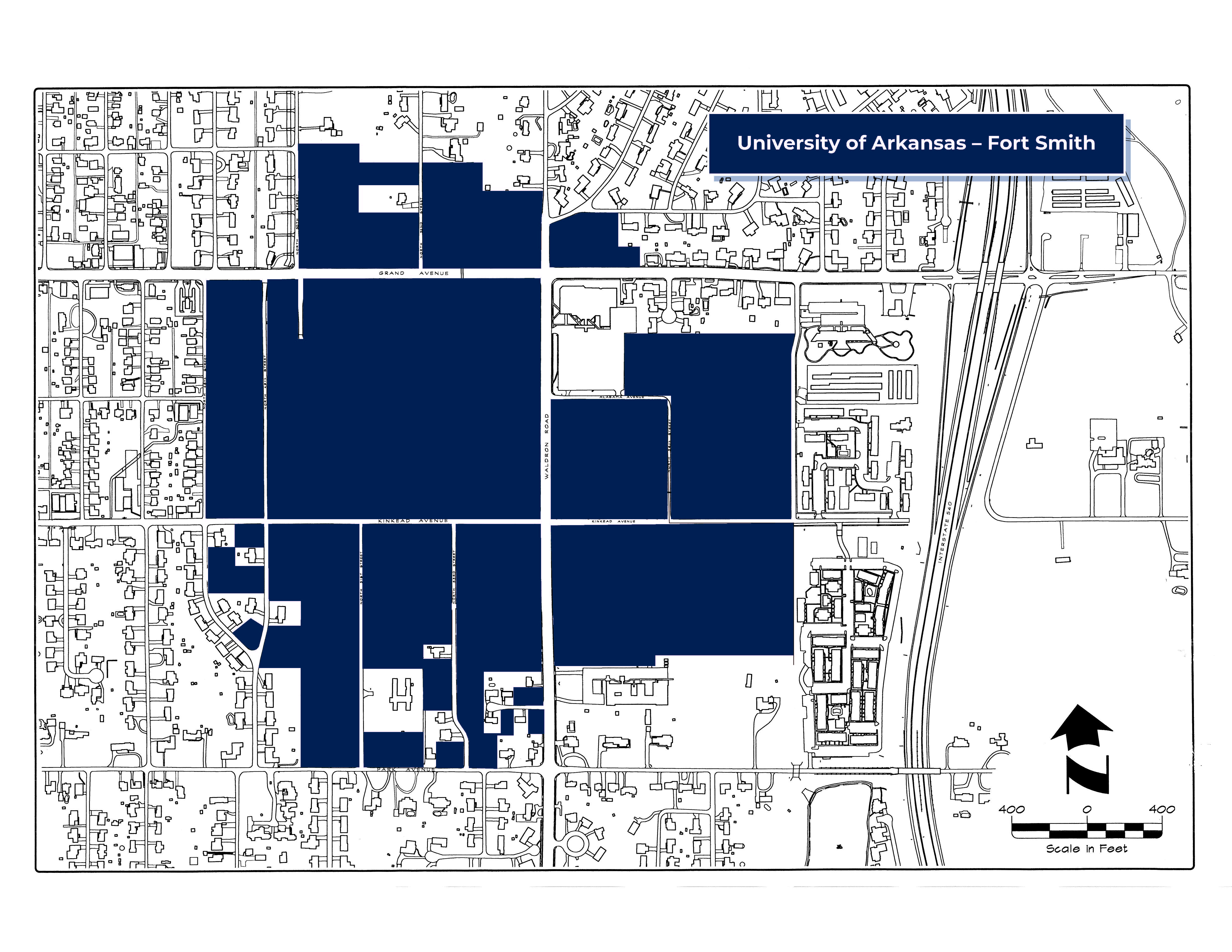
Understanding the UAFS Clery Geography Map
The UAFS Clery Geography Map is a vital part of our commitment to campus safety and transparency. It helps students, employees, and visitors understand which areas fall under the reporting requirements of the Jeanne Clery Disclosure of Campus Security Policy and Campus Crime Statistics Act (commonly known as the Clery Act).
What the Map Shows
This map outlines specific geographic zones where UAFS is required to track and report crimes, as defined by federal law. These zones include:
- On-Campus Property: Buildings and grounds owned or controlled by UAFS that are used in direct support of the university’s educational mission.
- On-Campus Residential Facilities: Subset of on-campus property dedicated to student housing.
- Non-Campus Property: Buildings or spaces not located on campus but owned or controlled by UAFS and used for educational purposes, such as locations used for off-campus classes or student trips.
- Public Property: Areas immediately adjacent to campus, such as sidewalks, streets, and public parking lots that are within the campus vicinity and accessible to the campus community.
Why It Matters
The Clery Act is designed to keep university communities informed about campus crime and safety procedures. By identifying these zones:
- UAFS can accurately collect and report crime statistics.
- Students and families can make informed decisions about safety.
- The university fulfills its legal responsibility to provide transparency.
View Clery Map PDF
Need Assistance?
If you have questions about the Clery Map or campus safety in general, please contact the UAFS University Police Department (UPD) at 479-788-7140 or visit the UPD homepage.